Welcome
Welcome to my homepage. I am a PhD candidate in Cartography and Geographic Information Engineering from School of Remote Sensing Information Engineering, Wuhan University. I hold a Master’s degree in Surveying and Mapping Engineering from The Academy of Digital China, Fuzhou University.
My research focuses on 3D GIS, 3D City Modelling, and 3D Geographic Information Services. I have worked on projects such as photo-realistic 3D mesh objectization, 3D photo-realistic building reconstruction, Open Geospatial Engine development, and the construction of a virtual geographic environment for 3D simulation of dam failure.
Currently, I am a visiting scholar at the Urban Analytics Lab, National University of Singapore, and I am working with Dr. Filip Biljecki.
News
- Received scholarship from China Scholarship Council to visit NUS UAL
 ->
->

- Top Prize of Science and Technology Progress in Surveying and Mapping, Granted by Chinese Society for Geodesy, Photogrammetry and Cartography
- Selected for the 24th Wang Zhi Zhuo Innovation Talent Award
- Selected for the Academic Innovation Award of Wuhan University
- Selected for the PhD National Scholarship of China
Featured Publications
We prpoased a novel bidirectionally greedy framework to extract fine-grained 3D building models from photo-realistic 3D meshes in an unsupervised manner.
Dayu Yu, Peng Yue, Fan Ye, Deodato Tapete & Zheheng Liang Automation in Construction, 52: 104917, 2023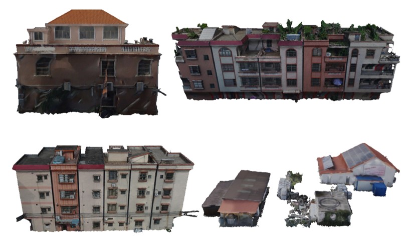
We propose a robust cloth simulation method for filtering ground primitives from photo-realistic 3D meshes. The method can accurately decompose the realistic 3D meshes into the 3D ground and non-ground 3D model, and it is robust for different landscapes and is not impacted by vertex density and noise.
Dayu Yu, Lianlian He, Fan Ye, Liangcun Jiang, Chenxiao Zhang, Zhe Fang & Zheheng LiangInternational Journal of Applied Earth Observation and Geoinformation, 111: 102820, 2022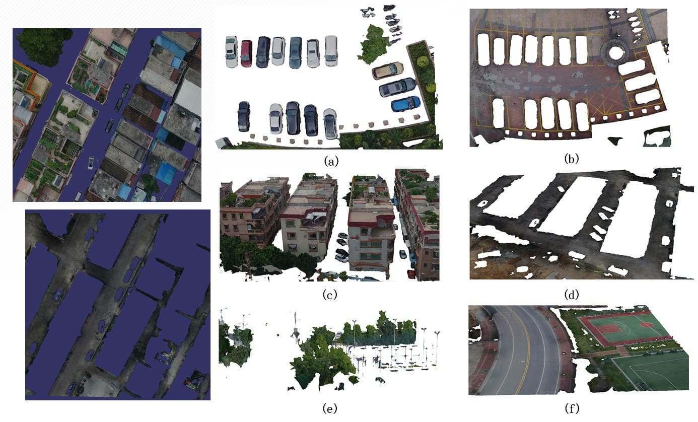
Building upon the physical properties of tailings flow, we developed a VGE platform for dam failure disaster evolution simulation, which can simulate and predicts the route and disaster-causing range of tailings after a failure, and visualize the results in a three-dimensional, dynamic and interactive manner.
Dayu Yu, Liyu Tang, Fan Ye, & Chongcheng ChenInternational Journal of Digital Earth, 14(9): 1194-1212, 2021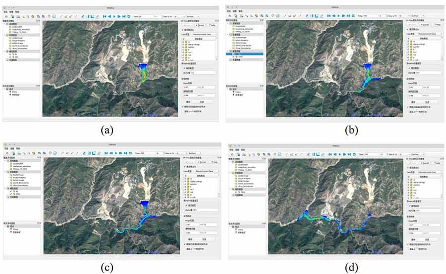
Get in Touch
Please do not hesitate to reach out if you have an interesting idea for collaboration, have some research opportunity to share, or would like to discuss some ideas. I have a broad interest in all things 3D GIS, not limited to, 3D City Modelling, 3D Geographic Information Services, Virtualized Geographical Environment, 3D Visualization, and 3D Spatial Data Infrastructure. Looking forward to connecting and hearing from you!